
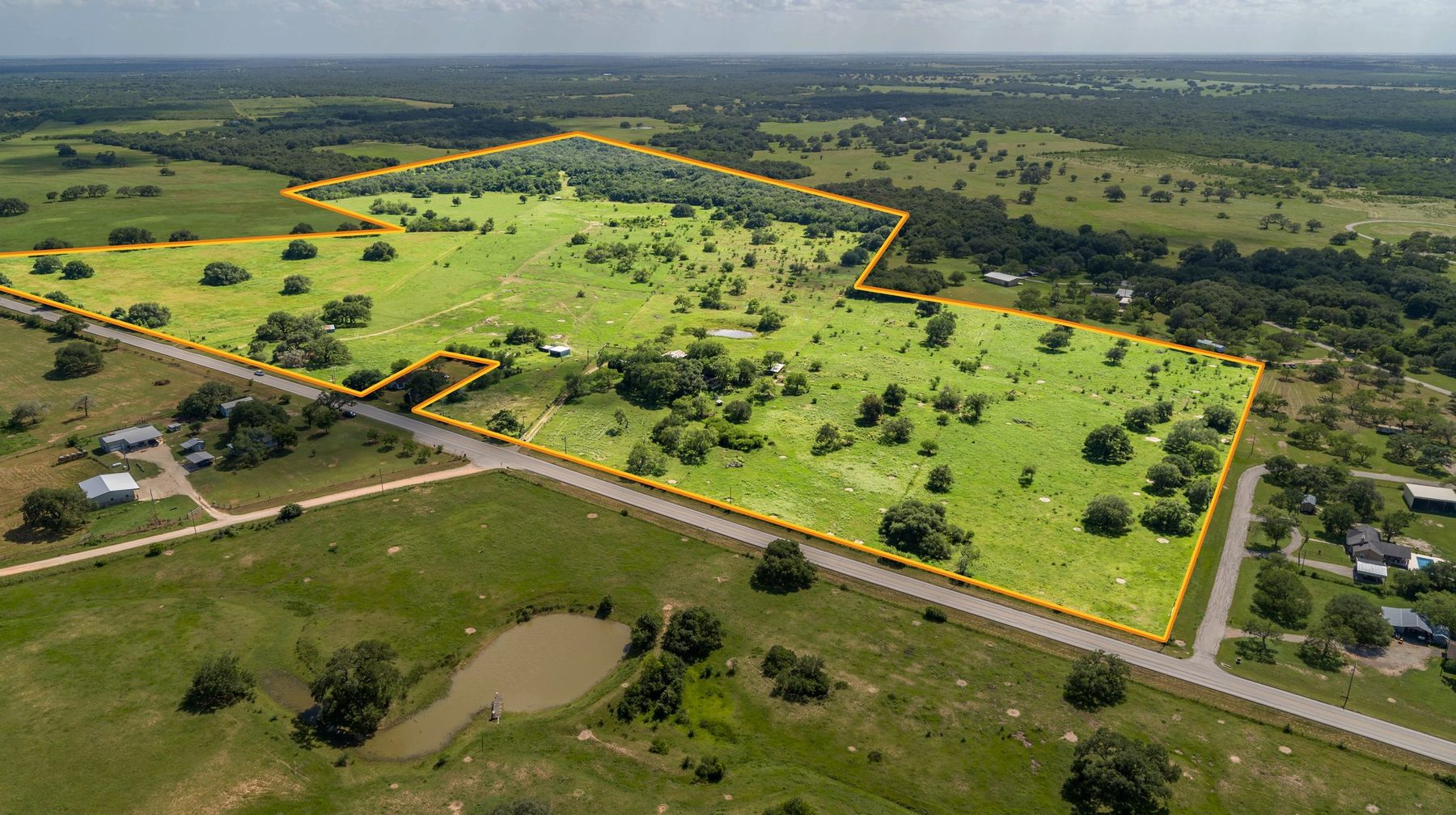
Every one of our real estate packages includes a single aerial property-boundary-overlay image. It's the one image we push to be the first thing a buyer sees after the hero shot.
Why
When you look at an aerial of a 200-acre ranch, it looks like the world. You can't tell where the deed ends and the neighbor's hay fields begin. The boundary overlay draws the actual parcel line in a bright, easily visible color. It makes the listing feel owned. It makes the acreage feel real instead of theoretical.
What we need from you
- Your plat map or survey PDF — even a rough county GIS export works
- The parcel / APN number for the listing
- Any easements or water rights you want highlighted
We trace the boundary in the air and burn it in at a resolution that holds up from a MLS thumbnail right through a printed brochure. It is not a legal survey. It is a marketing overlay. The surveyor's numbers are still king. Ours is built to sell.
Send us the map with your booking. We'll have the overlay ready alongside the rest of the delivery.